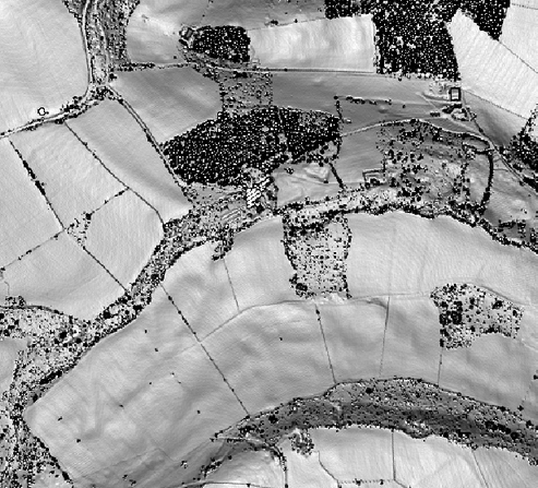
An extract from the Derwent Valley lidar (a pilot study towards the DerwentWISE project). Experimenting with different visualisation techniques. Conventional relief shading, although quite easy to understand, has its downsides in that results can be very dependent on lighting direction. A raft of other techniques has been tried - Sky View Factor, Local Relief Modelling, Insolation Modelling - to varying (but often very good)effect. This plot uses modelling of Slope Severity with pleasing results. I'm particularly interested in the mounds on the hill-top at the north of the image. They don't seem to have been recognised before. Too regular to be natural?
No comments:
Post a Comment